Sunday, August 1, 2010

Daley Ranch

Much to my surprise, I was able to mix in a last minute spin around Daley this evening with Mark and Doug. After a day of errands and whatnot I made it home in time to pack up the Tahoe and get over to Daley right around 5:30. I haven't really taken advantage of the longer days much this year, but at least today I was making the most of the daylight I had.

We started from the main lot and did the traditional Creek Crossing to East Ridge to Sage climb. Near the top of the first part of Sage I convinced the guys to do the bonus trail that Ben and I had done a few months ago. We took the Quail something singletrack down to Caballo, then climbed Caballo back to Sage and repeated a bit of the climb we had just done. The Quail singletrack was fun but a little blown out from the lack of rain. It was worth the detour to me, and I was surprisingly not bothered too much from the bonus climbing at that point.

We then continued up Sage to Diamondback and Coyote Run, then took East Ridge over to Jack Creek Meadow. We then took the east side of the meadow over to Hidden Spring (Cardiac). People complain about Cardiac, and with good reason. Its a monster. But what I really hate is the stupid meadow. Its 1.75 miles and has a small uphill grade the whole way. Its not difficult, per se, just unpleasant. And then when you're done with the meadow, you are faced with Cardiac.

I hiked the hard part of Cardiac as usual, and had an amusing exchange with a couple of other riders as they were coming down. One guy mentioned as he flew by us that "we had a long way to go." I simply thanked him for his insight and continued with the story I was in the middle of telling to Mark and Doug. You probably had to be there.

From the top of Cardiac we took Engleman Oak to Cougar Ridge, and Cougar Ridge to Crest. I love the Crest singletrack, and didn't even stop for the tarantula that was in the trail as I flew by. It was the first tarantula I'd seen in the wild, but all I really got was a glimpse. I think Doug and Mark stopped behind me and examined it further.

From Crest we took the road back to the cars and hung out for a bit catching up. I always really enjoy riding with Doug and Mark, and this time was no exception. Mark was on his SS as usual, and Doug has gone pretty much full time 1X9 which is also impressive. I like my gears, and have no intention of giving them up.

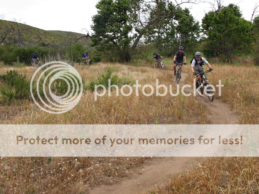
I didn't bring the camera, so no pics this time. Great ride though, with great company.

Here are the stats:

Total Distance: 12.85 miles
Total Time: 1:45:09
Elevation gain: 2,000 feet
Elevation loss: 2,005 feet
Average Speed: 7.3 mph
Top Speed: 29.2 mph
Avg HR: 168
Max HR: 194
Bike: Intense Spider XVP

Friday, June 11, 2010

SART


After more than two years of wanting to ride this trail, I finally had the opportunity to ride SART today. A couple of weeks ago Doug mentioned that he, Jeremy, and Mark were heading up there on a weekday, so I bailed on my Friday contract work and elected to tag along.

I left my house at 4:45 am in order to pick up Mark at his place at 5:30, and we made it to Doug's by 6. A few minutes later we were on our way up to Angelus Oaks. The drive wasn't too bad, though we did hit some rain near Redlands that initially had us concerned. After driving up a little higher in elevation to the trailhead, however, the sky was clear and the weather was crisp and beautiful.

We were wheels rolling at around 8:20 AM, and the ride began with an awesome extended downhill singletrack section. Swoopy, buff, and fast, the trail wound its way through the forest, switching back every now and then and adding in just enough exposure to keep us on our toes.

Mark liked this section.


As we shed elevation, the fog returned.


Finally we reached the end of the sustained downhill section, and regrouped.


Then we were back on our way.


Pausing now and again to take in the beauty around us.


And to scale fallen trees...


There was even a spot where a stream had been re-routed onto the trail, requiring a short bit of hiking...


Before getting back to the task at hand.


We were forced to make a few stream crossings...


Some of which, despite their beauty...


Proved treacherous:


On this particular crossing, Mark had ridden slightly ahead of me, and as I rounded a corner on approach, he yelled to me that it looked crossable on the bike. I pedaled faster and carried enough speed and momentum to make it across, despite the large, mostly hidden hole in the center of the stream. I yelled back to Mark to warn him of the low spot in the middle, and then readied my camera to document his attempt. I'm glad I did.

Mark's endo landed him squarely in the middle of the stream, and fortunately the only damage was a slightly bruised ankle (and incrementally more bruised ego.) After a few minutes of drying off and some ibuprofin, we were back on our way.

We crossed Glass road, and began the section of sustained climbing that took us toward South Fork Campground. The trail wasn't that steep or technical, but I was not feeling on my game. I managed to clean all but one short, steep, rocky climb, but felt less than great for most of it. After about an hour, we made it to the campground, where we broke for lunch and re-filled our bottles and camelbaks.

We eventually left the campground and headed back the way we came. Once again we were briefly climbing, and my legs began to protest in earnest. After less than a mile though, the trail turned mostly downhill, and we were rewarded with an awesome sweeping single track descent. We covered the distance back to Glass Road in a fraction of the time it had taken going the other way, and Mark and I finished within seconds of each other, both wearing ear-to-ear grins. That last two miles of singletrack before the road were probably the best of the day, and they alone probably made the whole ride worth it.

After regrouping, we made our way back across the streams we had crossed earlier (including the now christened "Landis Landing" crossing, and enjoyed more singletrack goodness for several miles. The rolling terrain trended downhill as we headed this direction, and proved to be even more fun than the "out" portion of the ride had been.

We finally finished gorging on singletrack, and the time came to pay back the debt we had incurred with all of our decent. Our finishing section involved more than three miles of fireroad climbing up Middle Control road, which was not the ideal way to finish a ride. Mark, who singlespeeded the entire ride, took off early, and was not heard from or seen again until the car.

Doug, Jeremy, and I rode together most of the way, until Doug began to pull away from us near the finish. Doug and Jeremy had elected to ride their 1X9 bikes, so as a gesture of solidarity, I middle ringed the whole climb with them. It sucked. I like my granny gear. But props to the other three guys for doing the ride with fewer gears than most sane people would, they had an impressive showing.

After packing up, we headed down into Mentone to hit up Cuca's Mexican Restaurant for post ride recovery food. From there we headed back home, mostly avoiding Friday traffic through Riverside and Temecula.

It was an awesome day, and I am thrilled to have finally been able to ride this trail. Its been on my to-do list for more than two years, and I likely won't wait that long to go back. Great company, awesome trails, and beautiful weather; it was a tremendous day enjoying God's creation, and I am grateful to have had the opportunity.

Stats:

Total Distance: 32.26 miles
Total Time: 7:24:59
Elevation gain: 4,468 feet
Elevation loss: 4,461 feet
Average Speed: 4.3 mph
Top Speed: 20.8 mph
Avg HR: 141
Max HR: 174
Bike: Intense Spider XVP
Garmin Training Center Log

Saturday, May 22, 2010

Sycamore Canyon/Farmer's Market Trail

This morning brought a fun, invite-only DT ride that started differently than expected, but certainly delivered at the end.

I met up with Sean, Brent, Mark, Ben, and about a dozen other DT folks at the Costco in Poway and we headed out en masse.

We quickly encountered a short steep climb, which I was pleased to clean despite the lack of warm-up.


From there we rode some lunch-ride type singletrack that soon took us to Sycamore Canyon Road.
We climbed the road up to the Martha's Grove trailhead.

Where we shed some layers and started up. I cleaned both the entire climb and descent, which felt good and is never a given.

After the fun section out of Martha's we regrouped briefly and headed out into Sycamore Canyon. We rode south through the canyon all the way to the powerline towers, and then climbed up the switchbacks headed back north.

Fun singletrack in the canyon:
Getting ready to head up the switchbacks:

Heading up:

Still climbing in formation:

At least you can see where the trail is headed:

And then the payoff begins:


I actually felt pretty strong all the way up the switchbacks, and even passed a few riders on the way up. Descending felt good as well, as I cleaned all of the downhill switches without dabbing and concentrated on carrying a little more speed than usual.

At the bottom of switchbacks we headed back the way we came through the canyon toward Gooden Ranch House. Once there, we regrouped, rested, and observed the shenanigans:


We then headed back out for more action. I was surprised we hadn't ridden any of Sean's secret Farmer's Market Trail yet, since that was billed as the point of the ride. But I was riding well and having fun, so I was happy to blindly follow along and just try to enjoy the ride and the company.

Leaving the ranch house, we briefly hit a little more singletrack as we headed north:


And then it was time for Cardiac. I had heard about Cardiac, but never ridden it before. It was almost as bad as advertised, and despite riding strong for the first part of the ride, quickly got shot out the back as the goaters flew up the steep grade.

I wasn't last, and didn't have to HAB any of the climb, so I'll take that as a victory. I also enjoyed chatting with Sean during the second half of the climb up, which made it more bearable.

At the top of cardiac, we headed north along the fire road towards the upper Sycamore singletrack. After a few laps around the fun singletrack up top...


...we finally headed over to Farmer's Market. Before heading down Sean and Brent's masterpiece, Sean said a few words:

The trail was obviously a labor of love for him and Brent, and they did an excellent job creating something awesome out of nothing.


I was a little worked by that point, and had some trouble with the early technical sections, going off trail a few times and feeling like a moron. Ironically, once I got control of myself I was able to clean a really fun and challenging rocky section toward the bottom of the trail that several people weren't able to do. Evan was also able to make it, and Sean made this neat sequence shot:

At the end of Farmer's Market, we rode some more fun singletrack that took us under Scripps Poway Parkway and along some bonus trail on the north side of SPP.

We regrouped under the overpass for Sycamore Canyon Road, and several of us decided to take the road back due to time constraints.

It was an awesome ride, and I'm really glad I was able to see Sean and Brent's creation. I met some new DT folks, caught up with several old friends, and rode pretty well overall. Definitely a good day. It was also my first ride with Garmin Edge 705, so now I can include heart rate and accurate elevation figures in my stats postscripts here.

Stats:

Total Distance: 24.38 miles
Total Time: 4:31:19
Elevation gain: 3700 feet
Elevation loss: 3723 feet
Average Speed: 5.4 mph
Top Speed: 26.1 mph
Avg HR: 157
Max HR: 191
Bike: Intense Spider XVP

Saturday, March 6, 2010

Lake Hodges East (Mule Hill Trail)

After years of riding North and South Hodges, I finally decided to head east this morning. I parked at the self storage trailhead for North Hodges, and headed east on the San Pasqual/Mule Hill Trail.

Having never ridden it before, I didn't know exactly what to expect. As I wound through mile after mile of flat, wide trail, I began to realize why this trail does not get a lot of publicity.

The trail (road?) wound its way through some marshland that at one time comprised the eastern portion of Lake Hodges.

Then, after about four miles of sleep inducing trail, things began looking up. Both literally and figuratively.


The trail transformed into narrow, scenic singletrack that began to contour along the side of the hill. The climbing was moderate, but welcome after the extended warm up. After about a mile of singletrack climbing, I reached the top of the hill. From there I took this shot of the trail from whence I'd come:

From where I stopped initially, the trail seemed to descend to the northeast. I rode down a little ways and reached another viewpoint that enabled me to see where the rest of the trail led.

I elected to head back at that point, but had I continued I would have descended down towards Bandy Canyon and the Wild Animal Park (seen above). It looked like a fun descent, but time was short this morning, and I wasn't sure how far the trail went below. Subsequent research seemed to indicated that the trail went for another five miles or so, making this particular route a 20 mile out and back if you do the whole thing.

Instead, I turned around and enjoyed the fun descent back down the mile of singletrack I had just climbed, and then tried to keep as much speed going on the flat section back to the trailhead as possible.

After the ride Rach met up with me at the Centre City Cafe, where we had a nice breakfast.

Stats:

Total Distance: 10.58 miles
Total Time: 1:05:15
Elevation gain: 552 feet
Elevation loss: 541 feet
Average Speed: 9.7 mph
Top Speed: 21.0 mph
Bike: Intense Spider XVP

Tuesday, February 9, 2010

I've Joined Team World Vision

Over the next few months, I am running and riding with Team World Vision to help change lives in Africa and Haiti. I have entered a series of trail running and cycling events that will act as a platform for me to raise money for this important cause.

World Vision works with communities in desperate need to help provide things like clean water, nutritious food, education, medical care, and economic opportunity.

As I participate in athletic events over the next few months, I will be asking friends, family, and members of the community to join with me in supporting this important cause. Whether you can donate $1 or $1,000, your support will both bless the people of Africa and Haiti and encourage me to "run with perseverance the races marked out for me." (Hebrews 12:1.)

Here is a list of the events in which I will be participating as a member of Team World Vision:

Trail Running Events:

Chollas Lake 5K Trail Run

Black Mountain Summit 7K Trail Run

Mission Driven Eco Run 10k Trail Run

XTERRA Mission Gorge 5k Trail Run

XTERRA Black Mountain 5k Trail Run

Cycling Events:

Bike the Bay 2010

Tour de Poway

Warrior's Society Toad Festival

Will you make a tax-deductible donation to support my efforts? Together we can help change lives. To visit my personal fundraising page and make a secure online donation, click here.

World Vision is a Christian humanitarian organization dedicated to working with children, families, and their communities to reach their full potential by tackling the causes of poverty and injustice. World Vision serves all people regardless of religion, race, ethnicity, or gender.

To learn more about World Vision, visit http://www.worldvision.org.
To learn more about Team World Vision, visit http://www.teamworldvision.org

Thursday, February 4, 2010

South and North Hodges Night Ride

Tonight was a fairly basic Hodges ride, starting from the Poblado trailhead. My goal list involved doing more night riding this year, so I figured I'd better get started.

I did a little of the South side singletrack, crossed the new pedestrian/bike bridge, and rode the North side trails over to the docks. My plan was to go all the way to Hernandez Hideaway, but I realized mid-ride that I had not locked my truck and had left my laptop and all other worldly possessions inside.

That realization made for a ride back to the trailhead at race pace, and I arrived to find everything in place. What a blessing in the face of my stupidity.

It was a fun quick spin, and I hope to do this type of impromptu ride more often. Maybe next time I can rustle up some company.

Total Distance: 10.83miles
Total Time: 1:02:18
Ascent: 971 feet
Average Speed: 10.4 mph
Top Speed: 21.1 mph
Bike: Intense Spider XVP
Garmin Connect - Activity Details for Untitled

Sunday, January 17, 2010

Firestone to Work to Home Point to Point Ride

Today was one of those days where you plan everything out, and it actually ends up working out just like you hope. I love those days.

With vacation prep in full swing and a list of errands to do only partially complete, I wanted to find a way to combine some of my chores with a road ride. I was way overdue for an oil change in the Tahoe, and also had to pick something up at work in Escondido before we left town, so I started thinking about dropping the bike off at Firestone and riding the road bike to work.

I got on mapmyride.com, put together a route, and uploaded it to my Edge. The area near North County Fair in south Escondido was a bit of a mystery to me, but I found a neat site online that provided great instructions and an excellent map, so I figured I'd be fine.

I dropped the truck off at Firestone and headed north. I crossed the relatively new Hodges pedestrian/cycling bridge for the first time on a road bike, and successfully navigated the North County Fair connector thanks to the map. That area behind the mall was a short but beautiful section to ride, and I enjoyed it very much.

Time and miles passed quickly from that point, and I made it to work in just over a half hour. I grabbed what I needed to get and was back on my way two minutes later. Instead of doubling back, I headed west. After a brief stop for a Jamba Juice in Escondido, I headed down Del Dios Highway toward Rancho Santa Fe.

I had plotted out a course on mapmyride using google maps, but it became clear as I began climbing up Del Dios that the turn I had plotted on the map wasn't there. Still, I soon saw a sign for the entrance to The Lakes community, which I knew was part of my route, and headed down the road to the guard gate.

I had initially thought that there would be a pedestrian gate that I could just go through without issue, but that proved to be incorrect. After negotiating for several minutes with the guard, I was granted a day pass to go "check out the model homes" and was back on route! (I am extremely grateful that the guard hooked me up, because the alternative involved riding through all of Rancho Santa Fe back to San Dieguito Road. That would have meant time I didn't have and miles I wasn't prepared for.)

I cruised through The Lakes, which is a beautiful development, and soon found myself back on Camino del Norte headed home.

It was an extremely fun and interesting ride. Uploading the route to the GPS worked pretty well for route finding, but I still would really like an Edge 705 with street mapping capability to help when I get lost or miss a turn. Now that I know the route from RB to Escondido, I can consider commuting to work from home sometime, which would be nice. I am also amazed at how much more ground I cover in less time on the road bike as opposed to the mountainbike.

Here's the report:

Garmin Connect - Activity Details for Firestone to Work to Home Point to Point

Saturday, January 16, 2010

Santa Luz Loop from Home

Before leaving on vacation next week, I wanted to get in a MTB ride. Time was scarce this weekend with packing and other prep-work, so I decided to just stay local and ride the Santa Luz loop from home.

In keeping with my desire to ride new dirt this year, I attempted to at least put a slightly different spin on the ride. I left from home, and instead of riding the 4S trails to Carmel Valley road up to Black Mountain Community Park, I headed west into Lusardi Canyon and rode the steep trail up the back side to the Park.

I had ridden that trail a few times before in the past, and never cleaned it. This time I did. Its not technical at all, just steep, and I grinded away all the way up to the top. From there I rode along the fringes of the soccer fields and hooked up with the Santa Luz singletrack.

The singletrack ended way too quickly, as it always does, and from there I rode along the doubletrack that winds through the Santa Luz valley.

As I reached the brief paved connector street, I spotted one of those portable speed displays that the County puts up in certain areas to warn drivers about their speed. I was curious to see if it would register my speed as I rode by. Turned out it would!

Clearly I wasn't able to generate much speed holding my camera in one hand and riding with the other, but it was an entertaining experiment.

After that I rode through the neighborhood and over towards the two hills that mark the most difficult part of the loop. I cleaned the first fairly easily, which I have done several times in the past. This time, however, I also cleaned the second hill, which is something I have never done. The rains had made it much less loose than usual, which helped, but it still felt good to cross that one off my list.

From there my path took me back into Lusardi Canyon toward home.

I decided to explore a couple of faint double track trails as they led out of the canyon, which proved to be a minor mistake. They eventually petered out into overgrown brush, and I had to plow/bushwhack my way back to the road home as I reached the top.

Still, it was an enjoyable and satisfying ride. Cleaning the trail up to Black Mountain Community Park and both of the rough hills in the middle felt good, and it was nice to take advantage of the beautiful day.

Garmin Connect - Activity Details for Santa Luz Loop from Home