Wednesday, June 18, 2008

RR: Santa Margarita River Trail (SMaRT)

This evening I had a chance to do my first STR group ride out at the Santa Margarita River Trail. Joining me were Doug (Pacman), Bill (MTB Bill), Dan (Old Dog Dan), Alan (Dan's non-STR friend), Scott (Blue Rat), and Patrick (Team Fallbrook).

We rallied right on time at the trailhead at the end of North Stagecoach Road, and were on our way.

Doug had planned out the route ahead of time, and we started out down a short fire road.


From there we headed east along the 500 foot trail (so-named because it is 500 feet above sea level).

It was a great warm up; relatively flat and very scenic, with a little bit of undulation to keep things interesting. The impact of the 2007 fires was still evident, and Doug mentioned that the sandy double track we were riding had been singletrack in the past, before clean-up crews bulldozed much of it after the fires.

I enjoyed the 500 foot trail quite a bit. After a mile or so riding along the ridge above the river, we regrouped.

The trail dropped down into a tree covered section and we stopped just short of crossing the river.

From there, we apparently could have headed northeast and done some serious climbing on the other side of the river. Instead, we elected to do a short double back and take the Santa Margarita River Trail parallel to the river to the west.

The trail along the river was pretty neat. It was very scenic, and it was amazing to see how much the area had recovered since the fires in October.


We rode along at a moderate pace, and regrouped often.

There was one particularly steep climb along the river which some cleaned (Bill and Doug I think) and others didn't (Me). From there we rode a short downhill section, then wound our way through a fun rock garden section that lasted about a quarter mile or so. Doug apparently cleaned that as well, while I and several others had a few dabs. At one point in the rock garden, Scott had an awesome save and narrowly kept himself from going OTB headfirst. A few minutes later he was not so lucky, and ended up doing a graceful somersault into the bushes. True to form, however, he promptly jumped up unscathed.

After the rock garden section, we continued parallel to the river and passed through a rocky section that involved some short HAB's over some larger boulders. From there we rode a short distance to our turnaround point, the De Luz trailhead.

After a few minutes hanging out there, we headed back.

On the way back we took a short detour to a nice viewpoint overlooking the river. It was a sandy bog to get there, but the view was worth it. (Not sure this picture does it justice though.)

After that we had another relatively short but steep climb, followed by a fun descent back along the river. On the descent, Doug apparently nearly ran over Scott, and in so doing, Doug's front tire burped and lost some air. I don't know exactly what happened, so I'll have to let Doug fill in the details. Both lived to talk about it though, which is good.

We regrouped at a flat area near the end of the fire road that we had taken down from the trailhead, and were back at the cars soon thereafter. We spent quite a bit of time talking and hanging out at the trailhead after the ride was over, and I enjoyed getting to know everyone better.

This was a great experience for me as part of my first STR group ride. I've done other group rides before, but almost always with people I already knew well , so this was new to me. The pace was social and enjoyable after a long day at work, the company was great, and the trail was scenic with plenty of features to make it fun and interesting.

Thanks to Doug for playing tourguide, and to everyone else who came along and making my first STR ride a great experience. I hope to ride with all of you again sometime soon.

[Edit] The above description was posted on STR. Here are a couple of additional thoughts that I wanted to remember later, but didn't necessairly want all over STR.

First, it was great to finally get to meet and ride with Doug. Having read his blog for months, and corresponding by email and message board for a while, it was great to put a face with a screen name and blog personality. I hope we can ride together more often.

It was also pretty neat to meet and ride with Bill Porter, of MTB Bill fame. Like most others, I've used his site as a resource many times, and was pleased to learn that he is a totally down to earth, personable guy who was fun to ride with. I was a little worried that he wouldn't enjoy a 7 mile, relatively flat ride at a social pace, but he never showed a hint of impatience and didn't charge ahead or get annoyed. Really neat guy.

I've been hesitant to do an STR ride for a while, largely because I didn't want to be an anchor with a bunch of experienced riders that I didn't know. For today's ride, I was right about in the middle of the pack in terms of conditioning and ability, which was perfect, and I had a great time. Hopefully that is the case in future rides as well.

Here are the stats:

Total Distance: 7.30 miles
Total Time: 1:51:29
Ascent: 1161 feet
Average Speed: 3.9 mph
Top Speed: 22.7 mph
Bike: Specialized Enduro Elite
Map:

View Larger Map

Monday, June 16, 2008

RR: Cuyamaca Grand Loop

Today was a ride with the Skyline MTB group that has been on the calendar for a while. Even though Cuyamaca was not on my 2008 Ride List, I figured it would be a fun day and was looking forward to riding with friends.

As it turned out, Billy and I were the only ones who were able to make it, and we arranged last night to meet in La Mesa and carpool out to the mountains. The plans turned out perfect, and I was able to go to Performance Bike in La Mesa beforehand to get some supplies and use my coupon, and even dropped the Tahoe off at the Firestone where we met to get some long overdue work done.

We made it to the trailhead in Cuyamaca about 9:15, and were underway shortly there after. Just as we passed through the campground, we spotted a group of six or seven turkeys crossing the trail. I took a few pictures, but only this one really came out:

There were actually five or six turkeys. The others were camara shy.

The real ride started on a fire road outside of the campground and headed north. After a mile or so we exchanged the fire road for singletrack, and soon thereafter we began the first sustained climb of the day up part of the Soapstone fire road and the Upper Green Valley trail.

We climbed for about two or three miles, and it was a grind. Not super steep, and not technical, just sustained incline that proved tiring. I stopped and rested a couple times, but didn't HAB, and kept Billy in sight the whole time.

We reached the top of Upper Green Valley trail, and began a short singletrack descent that made its way along the road. It was pretty fun, and was narrow and swoopy for the most part. It was mostly nice to get a break from the climbing. The singletrack wound along a meadow, and I could see Lake Cuyamaca in the near distance.


From there we rode another half mile of singletrack, and after a short climb, found ourselves at an intersection. If we headed left, we would hook back up with the Soapstone fire road we rode at the very beginning, and the day would be over. If we headed right, we'd take the California riding and hiking trail to another system of trails, making it a much longer ride. We went right.

The next section was mostly fire road, and pretty rutted fire road at that. It was at least relatively flat, and we spun along enjoying the beautiful weather and scenery. There was still some evidence of the 2003 fires, which reminded me of how long certain areas can take to recover from that kind of devastation.

The fire road dumped us out on to the 79 for a short road ride, and we then made our way over to Milk Ranch Road for the next climb of the day.


The climb up Milk Ranch Road was another grind, even harder than the first climb of the day had been. I had to rest two or three times, and my back was pretty stiff after being bent over for so long. Again, the grade wasn't particularly steep, and it was not techy, just long.

At the top of Milk Ranch Road, we hung a left and began another sustained climb up to Azeala Springs. This time, the climb began with a steep, sandy, rutted section that I tried to clean, but spun out about halfway up.

I HAB'ed the last 20 yards or so, and then re-mounted for the climb. I had actually been feeling pretty good up to that point, for a change. My nutrition had been good, and my stomach, which is usually the first thing to go, had been feeling great. Also, despite the sustained climbs, my lungs and legs had been feeling pretty good. During the final climb up to Azeala Springs, my legs started to fatigue, making this ride the first time that my legs started to go before my lungs or stomach. I counted that as a victory.

The Azeala Springs climb lasted another two miles or so, and this time Billy opened up a pretty big gap on me. I was spinning away, and didn't HAB except for the short section at the beginning, but my pace was slow. It was still fire road, but the scenery was pretty good.

I eventually caught up to Billy at the rest spot near the top of the hill, and we rested for a few minutes and drank from the spring water they had there.


After that it was another short climb (you can see a theme here) up to the very top of Azalea Springs, which I made without stopping.

After all of that climbing, I was ready for the payoff. But then came the mechanical.

Just as we crested Azalea Springs, Billy noticed his rear tire was low. We pumped it up, and we rode on for a few yards, but he could tell immediately that it was not holding air. This development was a little annoying, but not catastrophic, and flats on the trails are a part of riding. Plus, Billy had two spare slime tubes in his pack, so he was covered.

At least he should have been covered.

He popped the leaky tire off his bike, and threw a new tube on. Using his CO2 cartridges, he pumped up the new tube. As he replaced the tire, however, he realized that the new tube was not holding air. Upon further inspection, we spotted a slice in the tube, right along the seam.

We double checked the inside of the tire and the rim, but there were no lingering sharp objects that would have caused the slice. So we chalked it up to a faulty tube, and decided to try his other spare. He put that one on the rim, began pumping, and the same exact thing happened. Apparently, the slime tubes he had purchased had manufacturer defects.

And now we had a problem. I didn't have any spare tubes, and neither of us had brought a patch kit. After more than 35 minutes of screwing around with these tire changes, we were out of options. We were about six miles from the car, and Billy had no way to get air in his rear tire.

We brainstormed for a few minutes, and couldn't come up with any solutions.

Here was where we had stopped:

We had the option of walking his bikes down the paved road back to the 79, and then going and getting the truck from there. But after thinking about it, Billy estimated that the paved road was actually a longer route than continuing down Azalea Springs fire road to Fern Flat fire road and back to the car.

So he began walking.

He told me to ride on ahead and I could wait for him at the car, but I wasn't going to just leave him behind. So I would ride downhill for a half mile or so, and then turn around and climb back up to where he was walking and ride alongside him for a bit, then repeat.

After about 2o minutes of this routine, we realized it was going to be a very long walk back to the car, and began brainstorming about possible solutions again. We decided to try to cut up one of the defective slime tubes to use as a patch for the original tube that had two small punctures.

Using my leatherman I got for Christmas, we cut up a piece of the defective slime tube and tried to affix it as a patch over the punctured tube. That didn't work. The slime was slippery, and kept the tube from staying put over the hole.

Then we tried medical tape. Billy wrapped tape around the punctures, and that seemed to work. The tube at least held some air, and we threw the tire back on and shot down the downhill. It was rutted and rocky, and the vibration was significant. We had to stop every mile or so to put air in Billy's tire, but at least it was holding enough to let him ride it.

We got to the end of Fern Flat fire road, and took the Pipeline fire road north back to the 79 instead of south to the singletrack like we had planned before the mechanical.

After a half mile on the Pipeline fire road, we hit the 79, and did a mile or so road ride back to the truck to finish the ride.

This was not a "fun" ride. The climbs were long and sustained, and while I felt as good as I ever have climbing, and avoided HABing almost entirely, the climbs were not really enjoyable. The views were beautiful, and the weather was virtually perfect, which made the ride better than it would have been otherwise. But between the long climbs and mechanicals, it wasn't a ton of fun.

Also, this route was about 80% fire road, which is never ideal. While I don't mind climbing fire road to get to downhill singletrack, that was not the case here. For this route, it was fire road climb to flat short singletrack to fire road climb to fire road descent. Meh.

I enjoyed riding with Billy, and was pleased with my riding overall. It just wasn't a particularly fun route, and is not one I'd do again unless I had a specific reason.

Here are the stats:

Total Distance: 20.07 miles
Total Time: 4:36:39
Ascent: 2705 feet
Average Speed: 4.4 mph
Top Speed: 29.3 mph
Bike: Specialized Enduro Elite
Map:

View Larger Map

Saturday, June 7, 2008

RR: Black Mountain

I had talked to Sean about doing the Warrior's Society Toad Festival today, but we agreed that the mileage and climbing were probably more than we were good for at this point, and we decided to do something more local.

After a review of my 2008 Ride List, I realized that I had not ridden a single new trail since March other than Sweetwater on Wednesday. While looking at the remaining 2008 rides, it seemed that for most of them I either needed a guide to show me around or they were too far away to ride today. Except for one. Black Mountain.

Black Mountain was close, on my ride list, and pretty navigable from the information I could find online. I did have some concerns about what routes to take, but I actually enjoy exploring, so I figured everything would be fine. Any lingering fears about what route to take were further allayed on Friday night, as I was doing laundry. I was washing the shorts that I had worn during Sean and my Santa Luz ride last week, and found the Black Mountain Open Space map that I had grabbed from the Santa Luz trailhead. The map (which you can see online here) contained information about all the trails on Black Mountain as well, which I had not noticed before. I looked it over Friday night, sketched out what seemed to be a good route, and was ready to go.
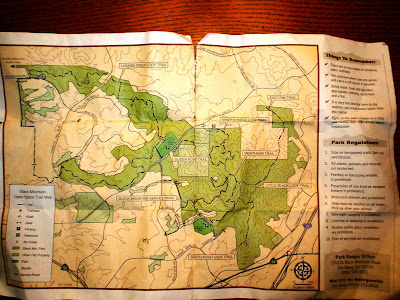
Sean picked me up at home around 8:00 a.m. We wanted to drive to the trailhead rather than ride, because we didn't want to burn all of our energy riding up Carmel Valley Road and through RPQ just to get to the dirt. We initially were going to start from the Maler Road trailhead, but when we got there we could see that it began with a steep fireroad climb right out of the gate. Looking at the map, we could see another nearby trailhead, off of Stargaze Road, that looked more promising. We drove the two streets over to get there, and found the Laurentian trailhead. That's where we started.

We got underway and began the main fire road climb up Black Mountain Service Road. I could describe the overall route we intended to take, but it is exactly the route we ended up doing, and I don't want to ruin the suspense.

The climb up Black Mountain Service Road wasn't easy, but it was nowhere near as hard as I had anticipated. It wasn't super steep, and I didn't have to HAB at all. I did stop to rest about three times, but maintained a pretty steady pace otherwise, and the rests were very short.

Near the top we arrived at the junction of the Black Mountain Service Road, the Nighthawk Trail, and what I'll call the "Miner's Connector Trail" (since its apparently unnamed). We consulted our trusty map, and decided to go ahead and finish the fire road up to the summit of the mountain where the towers are, and then ride back down to the junction and ride one of the trails from there.

The rest of the ride up the Black Mountain Service Road to the summit was relatively short, and while it did get a little steeper, I was still able to avoid any HAB's. We stopped just short of the top at an overlook, and enjoyed the views of Santa Luz and Rancho Santa Fe to the west. To the north, we could see 4S and the pond that we'd ride next to later.

From the overlook we also briefly hiked over to investigate a trail that headed off to the west that was not on the map. It began with a rutted, steep downhill followed by an equally steep and rutted climb. It seemed to go near the Glider Port Trail, but we couldn't tell where it went after it disappeared over a ridge.


We briefly considered taking it, but decided to stick with our original planned route. Then we finished up our ride to the top and took a few pictures.


From there it was a quick banzi down the fireroad back to the junction with the Nighthawk Trail. Nighthawk began with a relatively steep and rocky downhill, which I enjoyed and Sean hiked a bit of.

Here's the view from the top of Nighthawk:
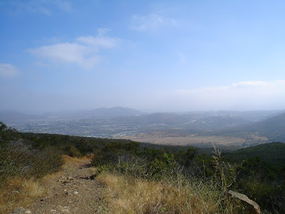
At the base of the initial drop, we had intended to take the Miner's Connector Trail over to the Miner's Ridge Loop trail and ride that loop. However, the entrance to the Miner's Connector Trail is easy to miss, and I shot by it the first time without noticing. It wasn't until I found myself at the intersection of Nighthawk Trail, Little Black Loop Trail, and East Rim Trail that I realized I had missed the connector to Miner's.

We doubled back, and found the Miner's Connector Trail. It was actually a pretty fun trail, with very narrow singletrack and some rocky sections to keep things interesting.

Here's the entrance to the Connector Trail:


And here's a short section of the Connector Trail:

After about a half mile, we hit Miner's Ridge Loop Trail, and had a decision to make. I wasn't sure whether we should ride it clockwise or counter-clockwise. I've heard arguments for both, and have hiked it in the past but never ridden it.

We decided to go clockwise, and I think it was the right decision. There was two or there spots on the first half of the loop that I had to HAB because they were particularly steep and rocky, but for the most part we were riding along great. The first half of the Loop ended with an awesome series of tight, waterbared downhill switchbacks, all of which I cleaned. It was an incredibly fun section. I waited at the main entrance of the Miner's Ridge Loop for a minute for Sean to show up, and we embarked on the second half of the Loop.

The second half of the Loop was mostly ridable at first, but as we got closer to our starting point at the Connector Trail, there were a few sustained HAB sections for me. They were steep and rocky, and I was feeling the climbs at that point.

We finally arrived back at the Connector Trail, and took it back over to the Nighthawk Trail. From there we headed over to the East Rim Trail. We were tired by that point, but were having a great time exploring, and we wanted to feel like we had seen as much of the mountain as possible.

The East Rim Trail actually was almost all fire road, and began with a short downhill section followed by an incredibly steep climb.

The climb was neither rutted nor loose, but Sean and I both found ourselves HABing pretty early on. After a little more than a quarter mile, we reached the top of the climb, and rode a short section of the trail before we had another, shorter HAB climb up to the ridge. From there we could see Carmel Mountain to the east and almost to the ocean to the west.

We knew there was a way from the ridge we were on back down to the meadow at the base of Black Mountain, but weren't completely sure where the trail was that would take us down. (I've heard that trail is called "Derailleur," and now I know why. But we'll get to that.) You can see on the map of our route at the bottom of this page where we would start down some singletrack off the East Rim Trail that would dead end in the brush, so we'd bushwhack back up to the main trail/fire road and keep going.

We kept making our way along the East Rim Trail, and after one last uphill HAB reached the end of the ridge and spotted the trail that would take us down. It was very steep. And rocky. And rutted. And steep. Just before we started down, we spotted an older couple hiking up the trail about 100 yards away. We waited for them to get to the top where we were, and were pretty impressed that these old people had hiked all the way up. We also knew that we didn't have any excuses for worrying about riding down the trial, seeing how senior citizens were walking up it...

I started down first, and it was pretty fun and definitely challenging. I worked the brakes to keep from skidding, and was careful to not let myself get caught riding down in the deep ruts that scarred the middle of the trail. It was as steep as it looked from the top, and was pretty long, so I found myself stopping about halfway down for a quick breather to give my quads and brakes a short rest.

After that I shot down the rest of the trail, and waited at the bottom near the pond for Sean to arrive. It was a pretty gnarly descent, and I felt good about making it without dabbing or falling.

Here's a pic from the bottom of the trail, looking back up Derailleur:


Here's a shot from that same spot, this time looking south towards Black Mountain:

Sean showed up a few minutes later, and we continued up the trail as it skirted the pond and the housing development and ended at Carmel Valley Road.

At that point, we realized we had been riding longer than we thought, and I had somewhere to be in less than an hour. Because of that, rather than road ride back up Carmel Valley Road, to Black Mountain Road, and up to the Laurentian trailhead, we took the 4S trails back to my house. I changed in record time, and we loaded Sean's bike on the back of the car and Rach and I dropped him back at his truck at the trailhead on the way out to our appointment.

The ride was a ton of fun, with awesome exploration and outstanding new trails. It took longer than we expected, and there was more HAB than I would have preferred, but for once the HAB didn't really take away from the joy of the experience.

I don't think I'd do the East Rim Trail again, just because the cost outweighed the benefits. The fire road climb(s) up to the ridge were really rough, and the downhill at derailleur was challenging, but not exactly fun becuase it was so steep and rutted out.

There were a few trails we didn't check out, and I'm looking forward to getting back there to ride them. I want to incorporate the Little Black Loop Trail next time, and maybe even the out and back section of the South Point View Trail. Also, that trail that we saw from the overlook near the top of the mountain that went near the gliderport seemed to end up connecting with the Miner's Ridge Loop Trail, so that may be on the agenda next time as well.

The biggest question I have about riding here again is how to end the ride. I'm thinking my route for next time will be something like this:

Laurentian trailhead up the Black Mountain Service Road to the summit;
Down Black Mountain Service Road to Nighthawk;
Nighthawk to Little Black Loop Trail;
Little Black Loop Trail to South Point View Trail (out and back, connecting back up to Little Black Loop Trail);
Little Black Loop Trail to Nighthawk;
Nighthawk south downhill to the Oviedo Trailhead;
Oviedo road ride back to Laurentian trailhead and finish.

That route is entirely on the south side of the mountain, and admittedly leaves off Miner's Ridge Loop trail which I enjoy. To remedy that, I plan to make a totally different ride out of the trails on the North side. For that ride, I'll do this route I think:

From home, ride 4S trails to Carmel Valley Road;
Carmel Valley road up paved road at Black Mountain Open Space Park.
From trailhead/parking lot, ride Miner's Ridge Loop Trail clockwise;
Back to the traihead/parking lot;
Ride down Canyon Rim Trail;
Back up paved road to trailhead/parking lot;
Down fire road trail across meadow;
Up trail along pond;
Back to Carmel Valley Rd, then across street to 4S trails and home.

My biggest regret is that neither of my two routes include the Miner's Connector Trail, which is a pretty fun section. So I may play with these routes to see if I can make something else fun out of them.

Either way I enjoyed Black Mountain way more than I expected, and will be back there soon, particularly considering its proximity.

Here are the stats:

Total Distance: 10.32 miles
Total Time: 2:44:07
Ascent: 2111 feet
Average Speed: 3.8 mph
Top Speed: 23.8 mph
Bike: Specialized Enduro Elite
Map:

View Larger Map


Wednesday, June 4, 2008

RR: Sweetwater Reservoir

I had a chance to do a rare midweek ride tonight that almost didn't happen for a number of reasons. I had been wanting to ride out at Sweetwater reservoir for a while now, and when I heard that World Cycles was hosting a weekly Wednesday afternoon/evening ride there, I decided this was my chance to have someone show me around.

Ironically, circumstances beyond my control conspired to make me almost bail on this ride, but in the end all of the stress and hassle to make it work was all worth it. First of all, after weeks of beautiful weather, a freak summer storm rolled in late this afternoon, and it began to rain around 3:00. It started as just a light drizzle, at least in north county, but as the afternoon rolled on, it began to really rain. I called Billy, who is friends with the folks at World Cycles to make sure they were still riding, and he confirmed that they were. Billy himself, however, did not attend, meaning I didn't know anyone else who was doing this ride.

The rain provided an easy excuse to ask to leave work a little early, and I bailed out at about 4:50. I'll skip the details, but the drive to Rancho San Diego was a horror show. I was in solid traffic from Carmel Mountain all the way to the 8, but after I hit the 8 things got better. I actually changed out of my work clothes and into my riding gear (padded shorts, t-shirt, rain jacket, and MTB shoes) while I was driving in traffic down the 15. I admit this was not the safest choice, but I knew I'd be cutting it close, and I wanted to give myself every chance to make it before the group left the trailhead. Since I had never ridden Sweetwater before, I didn't want to be out there alone in the rain and the pending darkness if possible.

I made it to the trailhead at the Steele bridge at 6:02, and as I pulled in I could see riders pedaling away at the far end of the bridge. It was at this point I was glad I had changed in route.

I quickly pulled the bike off the rack, threw the frame adapter into the car, and pedaled off, trying to catch the group. I saw them off in the distance a few times as I wound my way through the various singletrack trails that mark the early portion of the Sweetwater trail system. I was extraordinarily fortunate to catch brief glimpses of riders way off in the distance most of the times that I was faced with forks in the road, and as a result, didn't get lost.

I was pedaling almost as fast as I could, trying to catch up, but after some elevation changes and sharper turns, lost sight of the group. I decided to keep following the clearest tire tracks I could see and keep trying to catch them. I stayed left at the new wooden bridge, which turned out to be the right choice. About a mile and a half into the ride I spotted some riders ahead of me on the trail, slowing climbing some switchbacks. I called to them, and discovered that one of them was indeed Alex, the owner from World Cycles who had organized the ride. I was relieved to have caught the group, but a little fried from riding as hard as I had to catch up.

From there I rode up the switchbacks, and made my way though some fun, slightly techy up and down sections along the next portion of the trail. The scenery was great, and the trail was a lot of fun. After a mile or two, I came to a flat section of doubletrack that traversed a meadow along the northeast side of the lake. At that point one of the riders behind me caught up, and we chatted a bit as we rode along the flats. The problem was that he was riding at a much faster pace than I could manage, especially while trying to talk. After a mile or so, I was exhausted and eventually just gave up and dropped back.

Pretty soon we came to a small gate, where we regrouped. Several riders took off up the next section, which I realized after a short distance was an extended climb up the mountain. The terrain was mostly ridable for me, and the grade was steep but not horrible, but nonetheless I found myself fatigued about halfway up. I started HABing, and ended up getting passed by all but one of the other riders. It was a little embarrassing, but I am mostly at peace with my relative abilities at this point, and wasn't going to stress too much about it. Plus, there was at least one guy behind me, so I wasn't the anchor.

I finally crested the hill, and was rewarded with a short downhill that wound its way toward the lake. It was a fun section, and I rode it as fast as I could in an effort to catch the rest of the riders who had disappeared off into the distance. Alex was behind me with the other guy playing sweeper, so I wasn't worried about getting lost anymore.

As I rode the downhill back up a short section, I maintained my speed and kept pedaling through some tight turns. I was enjoying myself, and had the group in front of me back in sight. Then, out of nowhere, my front wheel washed out during a turn and I went down hard on my left side. It happened so fast I didn't have time to unclip, and my knee hit the ground first, followed by my left hand as I tried (foolishly) to brace myself. I skidded to a stop along the singletrack and quickly picked myself up. My shoulder hurt from trying to brace myself, and I could see a little blood on my knee, but I wasn't really hurt. Alex was close behind, and checked on me, but I was fine, if once again a little embarrassed.

From there we rode along some more fun singletrack, with a more gradual uphill that I was able to handle. The trail ran along an upper ridge above the lake for a while, and then turned toward the lake for a bit. As I reached a point of the trail that overlooked the lake, I saw three riders headed back up the trail towards me. Apparently this was the turnaround point for the group that wasn't going to ride down along the lake and up the steep switchbacks to the palapa. Truth be told, I wanted to take the switchback loop, if for no other reason than I don't like backtracking along trails I've already ridden. But I had made a fool of myself enough times for one ride, and decided that discretion was the better part of valor.

I doubled back the way I had came, riding the ups and downs of the trail as fast as I could. I kept up with the riders in front of me this time, and felt pretty good. We rode over to the palapa, where the group that had split off joined us a few minutes later.

We hung around for about 5 minutes, resting and taking in the views. At one point while the group was resting, one of the woman riders turned to one of the men and asked in Spanish if I had fallen. I understood, and responded in English directly to her that I had fallen, but was fine. She seemed a little surprised that I had understood, but was very nice, as were all of the people there.

After the brief rest the group headed down a short steep downhill section away from the palapa down toward the lake. It was a fun and somewhat challenging section, but I didn't have any problems, and actually pulled away from several of the riders behind me. That section continued downward for about a mile, and was the most entertaining portion of the entire ride. At the end of the downhill, we once again regrouped and headed back along the singletrack toward the Steele bridge.

I hung with the main group for the most part on the way back, even through some difficult uphill sections. I actually cleaned several steep ups that I wouldn't have been able to do in the past, and was feeling a little better about myself after my earlier mishaps. I also cleaned a tricky downhill spot that one of the female riders was walking. (As a side note, all of the people on this ride were extremely skilled riders, and all of them were very fast. One of the women in particular had the most impressive cycling legs I've ever seen on any person, male or female. They were hugely muscular and very defined, like a bodybuilder. It was a little scary, but she was very nice.)

We made it back to the cars before dark, and the rain had actually stopped about halfway through the ride. As I got back to my car and took off my helmet, I saw that my face was smudged all over with dirt, presumably from my earlier fall. I looked like a soldier with face paint on, and wondered what everyone else had thought as they saw me on the trail. Oh well. My leg also looked worse than it was.

I said my goodbyes and got ready to drive home. The windbreaker/rain shell I had worn did a nice job of keeping the rain off of me, but was also very insulating, and I had sweat even more than usual. My shirt was soaked, but I didn't want to put my dress shirt back on, so I drove home in a soaked biking shirt.

Despite the stress in getting to the ride and catching up with the group, I had a great time. Usually, factors like traffic, rain, being late, and riding with a group of strangers would make for a miserable riding experience, but I drove all the way home with a smile on my face. (At least until I ran into a ton of traffic near the stadium because of the Mexico/Argentina soccer friendly that was going on. That was a circus.) This was a fun trail, and there were literally dozens of alternate trails and offshoots there to explore that I saw. I can't wait to go back, and am really glad I didn't decide to bail on the way down. I'd like to maybe either start from the Bonita side next time, or just ride all the way to the Bonita trailhead from the Steele bridge in order to do the whole Sweetwater ride.

I also think I realized what had been contributing to my recent MTB funk that I referenced here. I've just gotten a little bored of my local trails, and it was great to ride in a new spot with some different challenges and new scenery and terrain. I was in a bit of a north county rut, and this was just the prescription I needed.

Here are the stats:

Total Distance: 12.18 miles
Total Time: 1:43:36
Ascent: 1413 feet
Average Speed: 7.1 mph
Top Speed: 24.6 mph
Bike: Specialized Enduro Elite
Map:

View Larger Map

Tuesday, June 3, 2008

RR: 4S/Black Mountain Loop

Rachel and I had dinner plans tonight that we had to cancel because Rach is still sick, so after going to vote and taking care of her for a while, I found myself with some free time around 7:00. I realized that with as much daylight as I had left, I might be able to fit in a quick version of my local ride. I love the summer and its long days...

I left from home and decided to just do my regular new local route. I rode through the 4S trails and up Carmel Valley Rd. to the Black Mountain trailhead. I made it to the top without even really getting tired, and rode over to Canyon Rim. I still had to HAB up both short steep uphills before the downhill of Canyon Rim, but that was par for the course. What frustrated me was that I had to dab once going down Canyon Rim, which I shouldn't have had to do.

I was so annoyed that I decided when I got to the bottom that I would loop it again, despite the waning daylight. I rode as quickly as I could back up to the top of the hill, and started over.

This time, I carried a little more speed into the section at the beginning of Canyon Rim where the short bridge is, and was actually able to ride up the first steep uphill section. I had never done that before, and was pretty pleased with myself.

I did still have to HAB the next uphill section, and don't foresee a time when I'll be able to ride that. Its steep and loose. But whatever.

For my second time down Canyon Rim, I was committed to not dabbing, and despite a close call, made it successfully. I was very glad at that point that I had decided to go back for a second lap, which erased the bad taste I had in my mouth from the first run.

I then rode back up the paved road to the Black Mountain trailhead, across the main trail for a bit and then downhill to the meadow. Tonight, I decided that rather than take the singletrack toward the pond and do the HAB up that section, I would take the closer trail that went uphill before the pond and connected with the pond trail near the houses. It was all ridable, and the climb was steady but not tough, and I liked the flow of that route better than my old alternative because I didn't have to do any walking. I'll probably alternate routes depending on my mood on a given day.

I made it home in less than an hour, even with the bonus loop down Canyon Rim. I hit the door at about 8:03 with some daylight left, which is good news for future late evening rides...

Here are the stats:

Total Distance: 7.76 miles
Total Time: 57:14
Ascent: 1,114 feet
Average Speed: 8.1 mph
Top Speed: 35.0 mph
Bike: Specialized Enduro Elite
Map:

View Larger Map